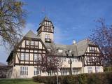
Winnipeg, Capital of Manitoba
Winnipeg is the largest city and capital of the Canadian province of Manitoba. Located at the eastern edge of the prairie region of Western Canada, Winnipeg plays a prominent role in transportation, finance, manufacturing, agriculture and education. Because all rail and highway traffic between eastern and western Canada must travel through or near the city, it is often called the "Gateway to the West".
The city is located near the geographic centre of North America on a flood plain at the confluence of the Red and Assiniboine rivers, a point now commonly known as The Forks.
Winnipeg lies in close proximity to hundreds of lakes, including Lake Winnipeg, Canada's fifth largest lake and the world's eleventh largest, as well as Lake Manitoba and the Lake of the Woods.
The city is a cultural centre and is the home of the Royal Winnipeg Ballet and the Winnipeg Symphony Orchestra. It boasts historic architecture, scenic waterways, numerous parks including Assiniboine Park, and distinctive neighbourhoods.
Winnipeg is about an hour's drive from the eastern beaches cottage country.
The Eastern Beaches Area is a favorite destination for Winnipeggers for a Day Trip.
winnipeg history
Winnipeg lies at the confluence of the Assiniboine River and the Red River, which is known as The Forks, a historic focal point on canoe river routes travelled by Aboriginal peoples for thousands of years. The name Winnipeg is a transcription of a western Cree word meaning "muddy waters".
The general area was popular for thousands of years by First Nations. In prehistory, through oral stories, archaeology, petroglyphs, rock art, and ancient artifacts, we know that natives would use the area for hunting, fishing, camps, trading, and some agriculture further north. The rivers provided transportation far and wide, and linked many peoples for trade and knowledge sharing, such as the Cree, Ojibway, Mandan, Assiniboine, Sioux, Lakota, and others
Geography and climate
Winnipeg is situated just west of the longitudinal centre of Canada (near the geographical centre of North America), and approximately 100 kilometres (60 miles) north of the border with the United States. It is near the eastern edge of the Canadian Prairies, and about 70 kilometres (45 miles) south of Lake Winnipeg. It is situated in the floodplain of the Red River and is surrounded by rich agricultural land. The closest urban area with over 500,000 people is the twin cities of Minneapolis-St. Paul, Minnesota.
Winnipeg has an extreme humid continental climate (Koppen climate classification Dfb). Spring and autumn are highly variable seasons, and winters are long and cold. In a typical year, daily average high temperatures range from around -14°C to 26°C; the recorded extremes are -45°C and 40.6°C (-49°F and 105.1°F). Winnipeg also reaches temperatures of above 30°C more often than other Canadian cities
See also our Manitoba business section
You are looking in other areas in Manitoba for businesses?
Check our business listings for Manitoba.
Author: Fredrick Buetefuer

